|
THE GREAT CALIFORNIA FLOOD OF 1862
BY
W. LEONARD TAYLOR M.D.
AND
ROBERT W. TAYLOR Ph.D.
SUMMARY
In 1860 California had been a state for 10 years. The state hired an excellent team of men from Yale, including Josiah Whitney and William Brewer, for a long term in-depth investigation of the state’s resources. They were just two years into their studies when the great flood of 1862 bankrupt the state, and soon thereafter terminated their lofty project. A fourth of the state’s economy was destroyed.
This flood transformed the Sacramento Valley into an inland sea, covering the tops of telegraph poles with steamboats passing over the farmlands to deliver goods and rescue survivors. The Santa Ana River formed two large lakes – one in the Inland Empire and another in the flood plain of Orange County. Probably the only definite high water mark in Southern California is at the Aqua Mansa, just south of the present city of Colton. Hydrologic studies at Aqua Mansa, document a discharge in 1862, three times the magnitude of anything since. In Northern California, a high-water measurement on the American River in 1862, suggesting a very high flow, appears to be ignored.
Considering the massive encroachment of human habitation into the river basins and flood planes of California one can only hope that should such an event recur -- present remedial action will be adequate. Warnings, however, as recently as 2003 by Dr. Arndt Schimmelmann of Indiana University, and many investigators reporting at a February, 2006 meeting of the American Association for the Advancement of Science, suggests otherwise.
INTRODUCTION
Water has always been a key issue in California. Oscillating cycles of flood and drought have characterized its climate. Our paper today is about a momentous flood. Considering its magnitude, it is hard to believe that it has been largely forgotten. Chances are, if you ask most anyone what they know about the great California flood of 1862, you will be met with a vacuous stare. You may recall William Fawcett’s 1999 Fortnightly Club presentation, on the Seven Oaks Dam. He pointed out that the Santa Ana River is rated as the greatest potential for disastrous flood damage west of the Mississippi. The huge Seven Oaks Dam was designed to help tame the flood waters of floods like that of 1862. The same is true for Prado Dam, and its current improvement. It remains to be seen to what extent such a wild animal can be domesticated. In any case let us examine the times and events of 1861 and 1862.
California had been a state for just 12 years at that time. The Gold Rush was 13 years old.
People were dreaming of constructing a railroad across the United States. The American Civil War was one year old, and the entire population of California, 500,000, was less than the number of troops fighting the Civil War. Telegraph poles marched from San Francisco to New York.
Two years before, despite all the distractions, the State appointed a forward thinking Supreme Court justice by the name of Stephen J. Field. He knew his state needed an official description of what its resources really were. He sought out the recommendations of major men of science in the east for a suitable director for such an enterprise. Josiah Dwight Whitney, a geology graduate from Yale was chosen. He was well known for his book, The Metallic Wealth of the United States. His appointment was in the form of a state Act dated April 21, 1860, appointing him State Geologist. His charge was "With the aid of such assistants as he may appoint, to make an accurate and complete Geological Survey of the State, and to furnish, in his report of the same, proper maps and diagrams thereof, with a full and scientific description of its rocks, fossils, soils, and minerals, and of its botanical and zoological productions, together with specimens of the same." Fortunately for us, he accepted. In remembrance of his efforts, the highest mountain in the continental United States located here in California was given his name. A second and most fortunate circumstance took place when he selected another Yale graduate to assist him. He was William H. Brewer, a botanist and an agriculturist. Brewer was also a compulsive diarist -- keeping detailed notes of his experience from 1860 to 1864. They were mostly letters to his brother, which were assembled into a book, Up and Down California. This book was printed by the Yale University Press in 1930. In 1966 this book, long out of print, was reprinted, and caught the eye of my brother, leading us eventually to this afternoon occasion. (As a footnote, the flood was so devastating to the state treasury that funding for Whitney's project sadly was not forthcoming, bringing it to an untimely end about 1864).
THE FLOOD IN SOUTHERN CALIFORNIA
On Friday, January 31, 1862, near the close of the deluge, Brewer writes, “At Los Angeles it rained incessantly for 28 days -- immense damage was done -- one whole village was destroyed.” He does not identify the town, but it seems highly probable that the town was a very important community right in our own back yard – the Agua Mansa. It was a well known community located just a little south of present day Colton. It was at the intersection of two main trails. One, the Santa Fe Trail from New Mexico to Los Angeles, and the other from Mission San Gabriel to its outpost, in what is now Redlands. “Before the Mormons arrived in 1851 the Aqua Mansans could boast that they had the largest town between New Mexico and the West Coast. (Quart Vol 47, Number 3&4, 2000, p.61) –“there was every evidence of prosperity” (SBC flood control district publication …1968 p. 4.)
“The location . . . was apparently ideal. The Santa Ana flowed through it in a well-defined channel, the lands on either side being forested with alders, sycamores, willows and cottonwoods. No serious flood had interfered with their growth for centuries, as the rich bottom land testified, and the seepage from the river encouraged the growth of lush grass. Where irrigation was needed, water from the river was easily available. The settlers had the privilege of cutting firewood and fence material . . . and their sheep, cattle, and horses had free range in the river bottom for miles”. Additional evidence that Brewer was referring to Agua Mansa, is in a report from a San Bernardino correspondent which appeared in the Los Angeles Star. “The Agua Mansa, a beautiful and flourishing settlement, is destroyed and no vestige is left to denote that such a place even existed.” (SBC Museum Quart Vol 47, Number 34, 2000. p. 61) It is probably from this paper than Brewer obtained his information that a whole town in southern California was destroyed. Fortunately for us, the report was inaccurate in a very important detail – as we will immediately discover.
So making the logical assumption that Aqua Mansa was the town referred to in “Up and Down California”– what do we know about the destruction of this town? Actually, -- a fair amount is known. There is an important archeological site within the community that has been the focus of periodic excavations from 1937 to 1990. This site is a church, or more importantly a step in front of what was once a church. Also there are the bases of two marble pillars marking the exact height of the Santa Ana River at its maximum, on that dreadful night of January 22, 1862. This marks the only exact bench mark of high water in our area. This church which survived the flood, escaped the attention of the Los Angeles Star reporter. This is extremely important as the step has been the reference level of two major hydrological investigations used in computation of the volume of water that came through that village. These will be described later.
But getting back to the flood story itself we have the following combined accounts from
William and Helen Beattie taken from the “Heritage of the Valley” (1951), Crafts, “Pioneer Days of the San Bernardino County” (1906), and Hayes, B. I, “Pioneer Notes from the Diaries of Judge Benjamin Hayes”. (1929).. The accounts state that the fall of 1861 was sunny, dry, and warm until Christmas day which proved to be a rainy day. All through the holidays there continued what we should call a nice, pleasant rain. It then rained continuously for fifteen days and nights. This was followed by a down pour for twenty-four hours, or longer. From accounts in the Los Angeles Star this storm continued for some 25 days. (Engstrom p.121) The Santa Ana River rose to the Pine’s Hotel located at the corner of present Third Street and Arrowhead Avenue in San Bernardino, inundating the Valley for miles up and down the river. All this was made worse by Lytle Creek rushing down D Street and crossing to Third. This corresponds to a water level higher than Barton road to the south of the Santa Ana River in the region of the Montecito Cemetery. Then on that night of January 22, a great roar was heard in the valley by Father Borgotta of the little church. He rang the church bell frantically and the inhabitants of Agua Mansa ran or swam to high ground. “The gentle Santa Ana River became a raging torrent which washing, swirling and seething, swept everything from its path.” One writer says there were “billows fifty feet high”. Peter C. Peters of Colton states that “when morning came – (there was) a scene of desolation. The village of Aqua Mansa was completely washed away . . . he watched the adobe houses melt down in the flood and disappear. Trees were uprooted, and carried along bodily, the land was cut and washed, and the fertile fields were buried under deposits of coarse sand and gravel. Only the church and a house near it remained.” (Sidler, 1966) Referring to the Diaries of Judge Benjamin Hayes, Engstrom states that even after the Aqua Mansa disaster there was particularly heavy precipitation from the 25th to the 27th of January (Engstrom, 1966 p.145). To what degree the Santa Ann River was at flood stage in the Inland Empire during this later period apparently is not recorded.
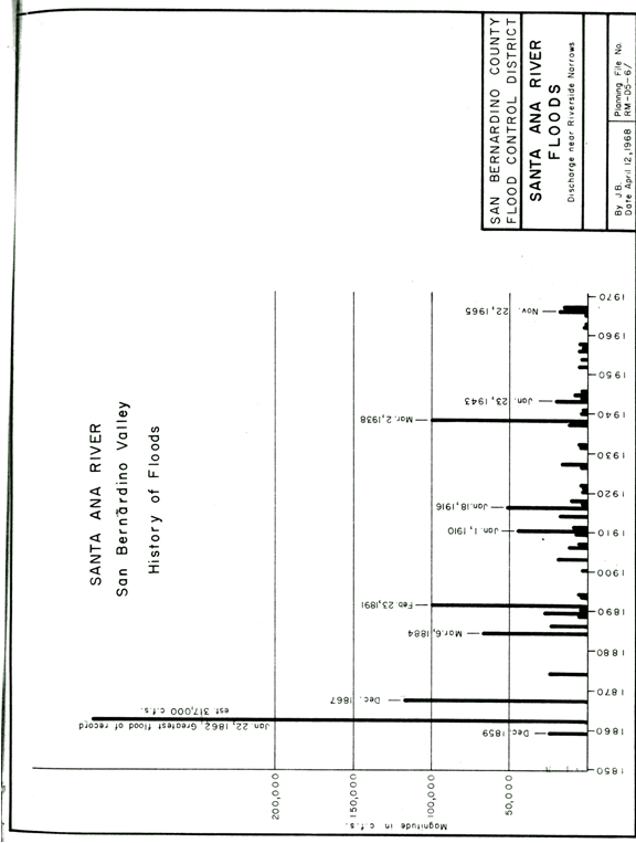
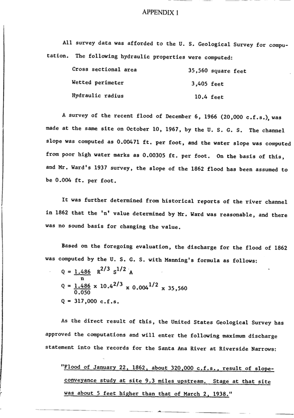
So, it is the step of this church which established the high water mark of this flood. Using this information, Mr. Ward, commissioned in 1937 by the San Bernardino County Board of Supervisors, along with a committee surveyed the cross section of the river bed and the slope of the river. He used established hydrological formulas (Appendix 1) and computed the flow. It was an astonishing 330, 000 cubic feet per second. He later recalculated it to be 314, 000 cubic feet per second. (Sidler
1966.
As you can well imagine these numbers became the subject of great controversy. The discussion raged for 30 years. To resolve the matter the United States Geological Survey made a compete reinvestigation! Their survey established a profile cross section of the river which was remarkably similar the profile Mr. Ward found in 1937. They then recomputed the flow with additional information provided by the March 2, 1938 flood. This calculation gave a flow of 320,000 cubic feet per second-- falling between Mr. Ward’s two determinations. (Sidler, 1966)
The storm of course, engulfed all of Southern California. Large lakes were formed on alluvial planes between Los Angeles and the ocean. They extended to the west and to the south. (Engstrom 1966, p.145) Lakes formed in the Mojave Desert. The Mojave River rose 20 feet above normal in present day Oro Grande. Planes were cut by gulches and arroyos from Ventura to San Luis Rey. (Engstom 1966, p.146) In San Diego during the month of January alone -- rain fall was 300% above normal. (Engstrom 1966, p.143) We do not have detailed precipitation figures for Los Angeles for this storm like we have for San Francisco. There is, however, a consensus among several individuals who “kept the rain fall” that over 66 inches fell during the 1861-1862 season. (Engstrom 1966, p.145) This number is interesting as compared to documented annual records kept in Los Angeles since 1878. (Los Angeles Times July 5, 2000, Metro News B8). Here, it is stated that the average rainfall in Los Angeles from 1878 to 1999 was 15.02 inches. We know that the flood created an inland sea in Orange County lasting about three weeks with water standing four feet deep up to four miles from the river. (Tracey Saltzman Sept, 1995 Saltzman. Tracey Planning Intern (1955) Huntington Beach Flood History.
To put things in perspective, the flood of 1938, which many of us can remember, resulted in the loss of 14 lives and $12,000,000 (1938 dollars) in San Bernardino County alone. One can only wonder what might be expected today with the increased population and the encroachment of building in river basins and flood planes since 1938, should an 1862 flood return. As can be seen in the bar graph below, the 1862 flood was more than 3 times the magnitude of the 1938 flood. (Sidler, 1968)
Moving ahead in time we find that the Orange county population increased from 516,000 in 1957 to 3,000,000 in 2005. Much of this was in the flood plane of the Santa Ana River. One can only hope that with the Prado Dam expansion and Seven Oaks Dam, the Santa Ana River can be controlled. Recently published investigations from sedimentary deposits in the Santa Barbara Basin, however, gives cause for alarm.
The U. S. Army Corps of Engineers in their planning for Southern California could not have made use of palaeoclimatic and archaeological evidence recently published in the Journal Holocene. Here Dr. Arndt Schimmelmann, senior scientist of the Department of Geological Sciences at Indiana University along with his colleagues found evidence for cyclic simultaneous flooding not only in Southern California, but also in Mesoamerica and South America.
These findings, published in 2003, were based on sediment cores taken in the Santa Barbara Basin. These cores contain tell tale sedimentary deposits, called varves, and they date back 2000 years. Measuring the thickness of the varve gives an index of associated erosion during that particular year. These have occurred in approximate 200 year intervals centering during the following years: 212, 440, 603, 1029, 1418, and 1605. It is observed that bicentennial flooding in the Santa Barbara area was ‘skipped’ only three times and never twice in a row. The quasi-periodicity of approximately 200 years for Southern California floods matches the approximate 200 year periodicities found in a variety of high-resolution palaeoclimatic archives, and more importantly a 208 year cycle of solar activity and inferred associated changes in atmospheric circulation. The last skip was in the early 1800s leading the authors to conclude: “we foresee the possibility for a historically unprecedented flooding in southern California during the first half of the century.” (Schimmelmann, 2003 p.770)
In personal communication with Dr. Schimmelmann there is no varve corresponding to the flood of 1862! This finding and its implications is currently under discussion but raises serious concern regarding public safety and economic loss in the near future, should this data prove to be prognostic.
THE FLOOD IN NORTHERN CALIFORNIA, FOUR CONTRIBUTING FACTORS FOR THE DEVESTATION
The great California flood of 1862 devastated Northern California as well as Southern California. That is one of the most remarkable aspects of this flood; it was statewide.
Floods were occurring everywhere in the state at nearly the same time. Bridges were washed our as far north as Trinity and Shasta Counties (Secrest, 2006).
Four factors contributed to this greatest of California’s historic floods.
1) Record Rainfall
2) High Population based along streams and rivers
3) Melting of snow.
4) Hydraulic mining.
The rainfall in Northern California set records not yet matched.
The following graph shows the average rainfall for San Francisco. Also shown is the rainfall for the two wettest seasons, 1861-1862 and 1997-1998. The rainfall in January 1862 has never been equaled; it was an amazing 24.36 inches. The second wettest month was February 1998, with about 15 inches of rain.
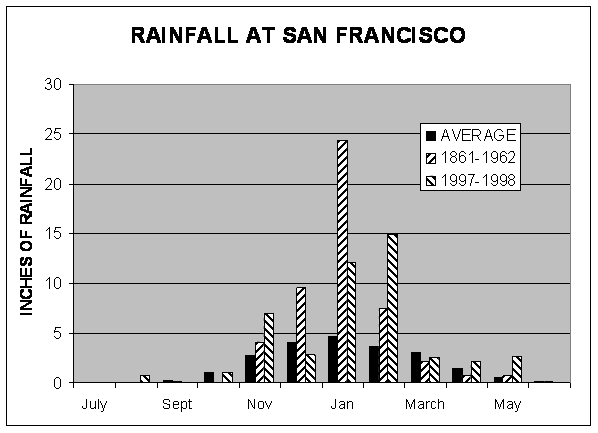
Data from Nolte, 1998, California Dept of Water Resources, 1950, McArdis, 1912 and Golden Gate Weather Services.
Brewer was in San Francisco on January 19, 1862, and wrote:
“The amount of rain that has fallen is unprecedented in the history of the state. In this city accurate observations have been kept since July 1853. For the years since, ending with July 1 each year, the amount of rain is known . . . This year, since November 6, when the first shower came, to January 18, it is thirty-two and three-quarters inches and it is still raining! But this is not all, generally twice, sometimes three times, as much falls in the mining districts on the slopes of the Sierra. This year at Sonora, in Tuolumne County, between November 11, 1861 and January 14, 1862, seventy-two inches (six feet) of water had fallen, and in numbers of places over five feet! And that in a period of two months.”
The unseasonable melting of the snow pack set the stage for down-stream disaster.
Heavy rain caused damaging floods in Sacramento during December 1861 when nearly 10 inches of rain fell. However, a lot of the December rain in Northern California was stored in California’s greatest reservoir, the snow pack in the Sierra Nevada Mountains. The depth was 10-15 feet. January brought more rain and warm winds and John Muir (1900) describes very well what happened:
“The Sierra Rivers are flooded every spring by the melting of the snow as regularly as the famous old Nile. Strange to say, the greatest floods occur in winter, when one would suppose all the wild waters would be muffled and chained in frost and snow…But at rare intervals, warm rains and warm winds invade the mountains, and push back the snow line from 2000 to 8000, or even higher, and then come the big floods.”
In 1862 more people lived in Northern California than in Southern California.
More people mean more property and the potential for more damage. The total population of California in 1862 was about 500,000 people, of which 100,000 lived in San Francisco. People tended to live along streams and rivers because water was necessary for agriculture, transportation, and mining. Of course, the flood risk was greatest near the streams and rivers.
Mining aggravated flooding in Northern California.
The streams and rivers of the Sierra Nevada in Northern California were being filled with an enormous volume of debris from mining, particularly hydraulic mining (Bancroft, 1890, p647). Log dams had been erected to retain this debris. These dams failed in the onslaught releasing a great wave of debris that surged downstream into the rivers and delta. The channels of the Feather, Yuba, and American Rivers were choked with boulders, cobbles, gravels, sand, and mud progressively down stream. A wave of fine sand and mud boiled down into the delta and ocean. The bed of the Sacramento River at Sacramento was raised more than 7 feet; the 2-foot tides were no more (Brewer, 1966, and Bancroft, 1890). The rivers flooded at lower flows because the channels were filled in. Gilbert (1917) estimated the volume of mine debris reached more than 1.5 billion cubic feet, before the practice of hydraulic mining was stopped by law Bloomfield vs. Woodruff, 1882). (This was the first federal environmental case, and the ruling was in favor of farmers, who were losing agricultural land, and against the miners who were releasing debris into the watersheds.) “No single industry in the history of California has generated more long-term environmental damage for such a meager economic return” (Mount, 1955. p. 210).
WHAT THIS GREAT FLOOD DID.
There are hundreds of first-hand accounts of the great 1862 flood. We have read many of the newspaper accounts. Many other first-hand accounts are preserved in personal correspondence of the time, as well as in legal and government documents. More information appears every year through the eye of the Internet, fed with a growing interest in genealogy and local history. Some of the accounts stretch the imagination, others, such as Brewer‘s, are the masterful writings of a seasoned observer. Taken together a clear picture of this devastating storm emerges.
There are no reliable estimates of the total loss of life in this flood. “An intelligent Chinaman said that the number of countrymen destroyed in the state in the December flood was 500.” This newspaper quotation is one of the few estimates, and it was for the lesser flooding of December 1861. (The quotation certainly reflects attitudes of the time toward all but white immigrants.)
The Sacramento Daily Union reported that 1/3 of the taxable property in the state of
California was lost, and also estimated that ¼ of all cattle were drowned (200,000). One house in eight was destroyed and 7/8 of all houses were damaged. The loss of all property was between $50 and $100 million (Brewer, 1966, p246). This sum corresponds to an average loss of between $100 and $200 for every person in the state. (The loss of cattle by flood, and the record drought year that followed, ended the early California cattle industry, and the cattle-based ranchero society (Jelinek, 1998/1999).
Brewer writes, on January 19, 1862:
“The great central valley of the state is under water – the Sacramento and San Joaquin valleys -- a region 250 to 300 miles long and an average of at least twenty miles wide, or probably three to three and a half millions of acres! Although much of it is not cultivated, yet a part of it is the garden of the state. Thousands of farms are entirely under water – cattle starving and drowning. All the roads in the middle of the state are impassable; so all mails are cut off. We have had no “‘Overland” for some weeks, so I can report no new arrivals... The telegraph also does not work clear through, but news has been coming for the last two days. In the Sacramento Valley for some distance the tops of the poles are under water. The entire valley was a lake extending from the mountains on one side to the coast range hills on the other. Steamers ran back over the ranches fourteen miles from the river, carrying stock, etc, to the hills.”
Remember Judge Field? He was responsible for support for Whitney and Brewer’s investigations. His home, although located on one of the higher areas of Sacramento, was filled with two feet of mud after the food waters subsided.
For a week the tides at the Golden Gate did not flood, rather there was continuous and forceful ebb of brown fresh water 18-20 feet deep pouring out above the salt water. A sea captain reported that his heavily laden ship foundered in the Gulf of the Farallons off of San Francisco, due to the layer of fresh water. Fresh-water fish were caught in San Francisco Bay for several months after the peaks of the flood. These events have not happened since. (Ellis 1936)
Bosque (1904) gives an account of flood damage to his farm in Moraga:
“During the winter of 1861-1862 a phenomenal rainfall flooded the country, involving great destruction of property in every direction. Our place, like others, suffered great damage. Some of our cattle and horses were drowned, and the center of the valley below our house, which had been a beautiful broad meadow before the flood, was washed away to a bed of sandstone forming its foundation. The valley was scarred by deep impassable bareness thirty to forty feet deep, and the face of the once beautiful place so changed that one could scarcely recognize it”.
Mats of tulles ½ mile of a side broke free of the delta islands and were carried out to sea in the flood. The mats moved down the coast in the prevailing southerly currents and were then driven on shore by wind, ending up on shores around Monterey Bay. Local farmers used pitchforks to kill the snakes, which came out of the grounded mats of tulles onto the beaches. (The Times of London, 1862)
The California State Capital was moved from Sacramento to San Francisco because of high water.
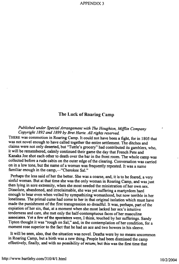
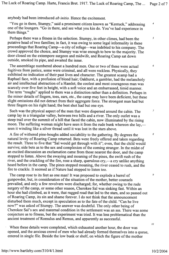
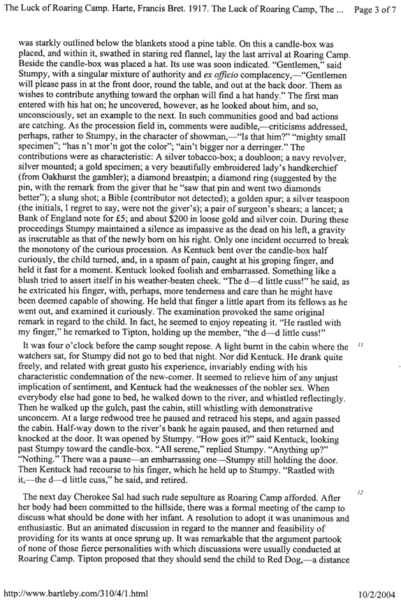
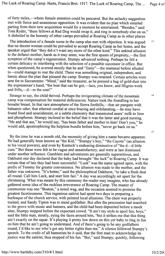
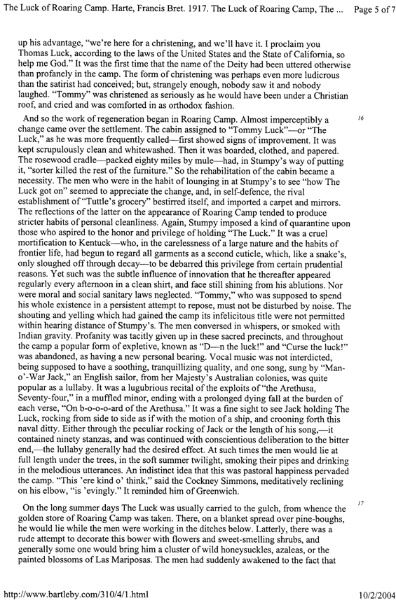
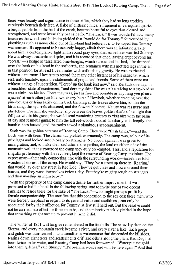
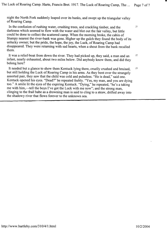
This great flood, almost certainly, was the inspiration for Bret Harte to write “The Luck of Roaring Camp” (see appendices 2 and 3) a short story, which made him (briefly) the best-paid author of his time.
We wonder why such a devastating flood is not better known, and taken into account in flood planning. For one reason there are few documented few high-water marks from which to estimate peak discharge rates from rivers. Another reason may be, as Ellis stated in 1920, this flood is not generally taken into account in flood planning simply because to have done so, the expense would have been prohibitive. A high-water mark of 183.0 feet above sea level was measured on January 10, 1862, on the Stockton and Coover’s stone stable on the American River near the town of Folsom. Walls of this stable remained during a flood in 1950 and were used to measure a high-water mark that year of 175.8-175.5 feet, corresponding to a flow of 180,000 cubic feet per second (cfs). This information is tabulated in Geological Survey, 1953. Also tabulated are peak flows on the American River for 5 other floods back to 1907. It is not clear why an estimate was not made for peak flow for the 1862 flood on this river. Extrapolating the data given, we estimate the peak flow in 1862 to be no less than 250,000 cfs.
BLOW-BY-BLOW CHRONOLGY FROM NEWSPAPERS OF THE TIME
December 1861
8th) Six inches of rain fell in Nevada City in 24 hours.
19th) Napa Reporter cites the start of rain.
San Francisco rainfall for December was 8.64 inches.
The month ended with a gale that blew barns down in Yolo County.
10-15 feet of snow accumulated in the Sierra Nevada.
January 1862
1st) After the flooding of December, the weather turned cold, and the temperature in San Francisco fell to 23oF.
5th) Deluge
9th) Sacramento hit by water from broken levees on the American River. By noon J, K and I Streets were under water. During the afternoon, floodwater rose at a rate of 1-foot/hour. “Water visible for miles from Sacramento...no dry land in the Sacramento Valley to Red Bluff except old Indian Mounds. Every day there are more drowning in the Feather, Yuba, and American Rivers.”
The Myers and Schaffer families, of Yolo County, put two chests of choice possessions in a boat, already nearly full of goods. The boat was tied to a tree in the farmyard where it turned this way and that with the shifting wind and steep waves. The raging storm made it impossible for them to escape to high ground across the new inland sea. They returned to the house and went upstairs where a fire was lit in the stove. At 9 o’clock in the evening the house toppled over. They were not hurt, and safely reached their boat. In a few minutes the house caught fire from the stove. Between the fire, wind, and water the house was completely destroyed, but they lived to tell the tale.
Napa was suffering with 4 feet of water and at Alvarado, at the mouth of Alameda Creek, the floodwater was 6-feet deep, and marooned citizens fired a gun every minute as a distress signal.
In Niles Canyon, on Alameda Creek, the Peale mill was washed away. The flood carried off the house of Mr. S. Bonner also on Alameda Creek in Sonol Valley, and the occupants escaped by climbing a tree where they remained for 24 hours
10th) In Sacramento at 9:00 pm, high water was 24 feet above low water, and the water was waist deep in downtown. “Sacramento is a city transformed into sort of a frontier Venice.”
Sacramento is out of food.
Brewer writes on the 19th of the response of San Francisco, which will resonate with the spirit of Redlands:
“Benevolent societies are active, boats have been sent up, and thousands are fleeing to this city. There have been some of the most stupendous charities I have ever seen. An example will suffice. A week ago today news came down by steamer of a worse condition at Sacramento than was anticipated. The news came at nine o’clock at night. Men went to work, and before daylight tons of provisions were ready –eleven thousand pounds of ham were cooked. Before night two steamers, with over thirty tons of cooked and prepared provisions, twenty-two tons of clothing, several thousand dollars in money, and boats with crews, etc were under way for the devastated city.”
Thousands of people escaped the flood by steamer to Benicia, which was the first high land down stream.
At the town of Alamo, in Amador Valley near Mt. Diablo, a disastrous short flood occurred at 3:00 in the morning. Many of the people fled as fast as possible and took refuge in the Academy and at Wolf’s brick store. The barn of Van Wagner was floated off. Seeley’s house capsized and furniture lost. George Engelmeyer has 1500 sacks of wheat lost and damaged. George Stone’s Barn, containing 5 tons of hay and 30 or 40 sacks of grain, destroyed. The barn and stable of Hoffman and White washed off, with a fine buggy. John Schwartz’ house floated off with all its contents into field some 100 yards distant. Mr. Hemme lost a large barn, fine carriage and fences. Twelve horses were swept 3 miles down-stream, but only one was lost. Lost cattle were identified by brands published in the newspaper.
Standing water on flat-topped buildings was a problem; the roof of the Montgomery St. Armory in San Francisco collapsed.
11th) Red Dog, Nevada County, 11 inches of rain in 48 hours before midnight. (We mention Red Dog because it was a key place in the novel “Luck of Roaring Camp”. Rainfall in Red Dog during December was 45 inches. The total for the season was 109.5 inches or 9 feet 1 ½ inches!)
“San Ramon Valley, one sheet of water from hill to hill as far as we can see”. Eldridge Lovling, aged 20, drowned while trying to cross a stream in Tassajara Valley, near Alamo. Six inches of snow fell at the coalmines near Livermore (The Contra Costa Gazette, 1862).
12th) “Levees on Mormon Slough broke and by evening all Stockton streets on low ground were canals. Stockton loses all bridges, sewers caving in, and the water is a foot deep in Washington Square.”
The Mokelumne River at Big Bar Bridge was 44 feet above low water
The stern - wheel steamer Victor averaged 31 mph in the 25-mile down-river run between Red Bluff and Tehema.
Landslide at the town of Volcano, 7 people perished.
All of Napa under 4 feet of water, Rio Vista under 6 feet of water, and Big Oak Flat completely destroyed. In Knight’s Ferry and Mokelumne Hill “nearly every building was torn from its foundation and carried off by thundering landslides“.
“Water in Sacramento at such a depth that no one attempted to move about the city except by boat.”
The State Treasurers office in the Capital Building has 3 feet of water in it.
A piano in the parlor of the Chief Justice, though perched upon chairs was soaked, and the pictures in the parlor were spoiled.
“Important people suffer; less important people more so.” “Confusion and consternation filled the city.” River steamers brought the dispatches-it became clear that “from Tehema to Stockton, from the Coast range to the Sierra Foothills Californians were fighting for their lives and property against the greatest flood in the recorded history of the state“. “A great sheet of yellow rippling water spread from the Coast Range to the Sierra Nevada”.
It appears that the telegraph was down therefore no rapid news got north and south in California until Feb. 1.
13th) In the Capitol at Sacramento a political battle was raging. “It may be safely said that a majority of the Senators and Assemblymen would be glad to see the Capitol removed (to San Francisco) and 9/10 would be glad to see it moved temporarily; but they do not wish to appear as personally doing anything that would contribute, even indirectly, to the misfortunes of a town already so severely affected…”
Others agued that the political center should not be in a large city with “the mob”. “Many, at any time of excitement, rise with over awe, some even to overthrow the administration.”
14th) A motion to move the capitol was defeated.
Books at the State Library got wet, and shelves collapsed.
Water depth at Suisun and Fairfield was 2-3 feet.
15th) Rain in Napa since December 19th. Telegraph cut off.
“Indians living near Marysville left their abodes a week or more ago for the foothills, predicting an unprecedented overflow. They told the whites that the water would be higher than it had for 30 years, and pointed high up on the trees and houses where it would come. The valley Indians have traditions that the water occasionally rises 15 or 20 feet higher that it has been at any time since settled by the whites. They said, the worse has yet to come”, Sacramento Daily Union (1862)
16th) A dispatch received from Mokelumne Hill: “Hell has broken loose here, look out down below in Stockton. And then the telegraph went dead.”(Sacramento Daily News).
The debate on the removal of Legislature rages on. The Howard Society feeds and aides flood victims.
20th) A high-water level was noted on a stone stable in the American River which we have used to make an estimate of the minimum peak discharge (Geological Survey, 1953).
23ed) Legislature votes to leave the Capital, one-account states, “A Trip to San Francisco is just now considered to be just the thing.”
24th) Legislature leaves Sacramento, for San Francisco.
27th) Ice, ¾ inch thick, in San Francisco. The hills are covered with snow.
29th) Six inches of snow fell in Napa, and 1 inch of snow in Sacramento.
FEBURARY 1862
1st) Two inches of snow falls at Pacheco.
News finally reaches Northern California about the flood in Southern California.
4th) Snow falls again in Napa Valley.
5th) Grass Valley had 66 days of rain out of the past 75 days. Sonora reports 8 feet 6 inches of rain from Nov 10 to Jan 23!
March 1862
Brewer visited Sacramento on March 6. He reports:
“Such a desolate scene I hope to never see again. Most of the city is still under water, and has been there for three months…over most of the city boats are still the only way to get around…”
Two Years Later
Brewer, (1966, p485), at Crescent City notes:
“The floods of two years ago brought down an immense amount of drift wood from all the rivers along the coast, and it was cast up along this part of the coast in quantities that stagger belief”.
WHAT WE HAVE LEARNED?
California had its greatest flood in 1862 that destroyed 1/4 of the property in the state.
Even small streams rise up to become killers.
Advise your children not to live or invest in property near California creeks, rivers. Live above or far away from the so-called 100-year flood plane.
Flood control dams and channels can worsen damage when floods exceed the design. (American Association for the Advancement of Science Feb 2006
We need to establish the frequency of great floods in California, and plan accordingly. (Sommerfield, 2002, and Warrick, 2004).
Presently we cannot say how frequently a flood like that of 1882 may occur. (For example on one hand we have records of Indians saying that they know of a time of higher water, on the other hand we have accounts of ancient Indian burial grounds opened by this flood, exposing hundreds of skulls, and accounts of 10-foot diameter oaks uprooted, suggesting this flood was a very rare occurrence (O’Brien, 1950).
And finally we learned that WITHOUT THIS FLOOD WE PROBABLY WOULD NEVER HEARD OF BRET HARTE!
APPENDIX 2
THE BACKGROUND OF THE PUBLICATION OF “THE LUCK OF ROARING CAMP”
The year was 1868. (Ellis, M., 1956) A most amazing tale was published in The Overland Monthly. (It was a new San Francisco publication and was a counterpart to The Atlantic Monthly) It was amazing in several details. To begin with, the tale was nearly killed before it was published. It turns out that Bret Harte, the editor of the monthly was reviewing its very first edition, called to the attention of the publisher, “. . . the lack of any distinctive Californian romance in its pages, and averred that, should no other contribution come in, he himself would supply the omission in the next number. No other contribution was offered, and the author . . . in a few days sent the manuscript of “The Luck of Roaring Camp” to the printer.
Harte had not yet received the proof-sheets when he was suddenly summoned to the office of the publisher, who was standing, the picture of dismay and anxiety with the proof before him. The indignation and stupefaction of Harte can be well understood when he was told the printer, instead of returning the proofs to him (Bret Hart) submitted them directly to the publisher. There was an emphatic declaration by the printer that the matter thereof was so indecent, irreligious, and improper that his proof-reader – a young lady – with difficulty was induced to continue its perusal. The printer, as a friend of the publisher and a well-wisher of the magazine, was impelled to present to him personally this shameless evidence of the manner in which the editor was imperiling the future of that enterprise. It should be premised that the critic was a man of character and standing, the head of a large printing establishment, a church member, and a deacon.
Bret Harte of course saw nothing objectionable in the story. The matter was discussed within the organization and the author found to his surprise, he was in the minority. After much additional debate and discussion, “the story was submitted to three gentlemen of culture and experience, friends of the publisher and author, -- who were unable, however, to come to a clear decision.” The author’s position was clearly at stake. The situation was delicate and the verbal dancing resulted in Bret Hart’s suggestion “that unless he was permitted to test his editorial ability by the publication of the story, and abide squarely by the result, he must resign his editorial position.” Somehow to our benefit 135 years latter the publisher, perhaps in response to the “author’s confidence”, yielded, and the “Luck of Roaring Camp was published.
Bret Harte suffered for days thinking that his story was considered to be “baleful fiction” assisting in “dangerous and subversive doctrines”. “What solemn protests must have been laid with the ink on the rollers and impressed upon those wicked sheets! What pious warning must have been secretly folded and stitched in the number of The Overland Monthly!” The secular press . . . received it coolly; the religious press frantically excommunicated it, and anathematized it as the offspring of evil. . . . Christians were cautioned against pollution by its contact . . . -- to say nothing on its adverse impact on Eastern immigration. While the west was in animated suspension over the fate of The Overland Monthly, the east had already made up its mind. By return mail The Atlantic Monthly sent Bret Harte, in flattering: terms, requests for more of the same! “The same mail brought newspapers and reviews welcoming the little foundling of Californian literature with an enthusiasm that half frightened its author”. The “Luck of Roaring Camp” became and instant success and Bret Harte was to become, in the next decade, the highest paid writer in America. (Internet reference)
The “Luck of Roaring Camp” was published a mere six years after the great flood of 1862. It is not known how long Bret Hart had this story formulating in his mind, but we do know he had been thinking about it for some time and knew of the events engulfing the state, before he drew his publishers attention “to the lack of any distinctive Californian romance” in the pages of The Overland Monthly. The story is set in 1851 in order to portray it in the in the beginning of the gold rush of 1849. This “baleful fiction” was anything but fiction and closely reflected the enormity of the 1862 flood. This touching story closes with the accurate observation: “The snow lay deep on the Sierras, and every mountain stream became a river, and every river a lake. Each gorge and gulch was transformed into a tumultuous watercourse that descended in the hillsides, tearing down giant trees and scattering its drift and debris along the plain. Red Dog (a near by camp) had been twice under water, and Roaring Camp had been forewarned. ‘Water put the gold into them gulches,’ said Stumpy. ‘It’s been here once and will be here again!’ And that night the North Fork suddenly leaped over its banks, and swept up the triangular valley of Roaring Camp…In the confusion of rushing water, crushing trees, and the crackling timber, and the darkness which seemed to flow with the water and blot out the fair valley, little could be done to collect the scattered camp. When morning broke, the cabin of Stumpy nearest the river-bank was gone. Higher up the gulch they found the body of its unlucky owner; but the pride, the hope, the joy, the Luck of Roaring Camp had disappeared. . .”(Harte, Brete 1868, See Appendix 3)
In this “baleful fiction” is recorded a story which was repeated thousands of times in every creek, gorge and gulch of the Sierras and in the mountains of Southern California. We can only hope that the lost of the infant child, Luck, was not repeated. Sadly, as one reflects on the great flood of 1862 the fate of Precious Luck was probably not an isolated event. It is an aspect of California history that has largely escaped the attention of the current generation; but must not be forgotten.
BIBLIOGRAPHY
American Association for the Advancement of Science, Feb 2006. “Development Raises Flood Risk Across the U.S.” http://news.yahoo.com/s/ap/20060219/ap_on_sc/next_new_orleans&printer=1;_ylt=Aml....
Alta California, San Francisco (also called Daily Alta California)
Bakker, E., “An Island Called California,” University of California Press, 1971
Bancroft, H. H. (1890) “History of California”, Vol. 8, 1860-1890, p647. (Printed in facsimile from the first American edition by Wallace Hebberd, Santa Barbara, 1970.)
Beattie, William and Helen, (1951) “Heritage of the Valley, San Bernardino’s First Century, Oakland: Brobodks
Bondi et al. (1997) Dendroclimatology of Torry Pines, American Midland Naturalist 138; 237-251
Bosque, Edward (1904) “Memoirs”, Self Published in 1904, Reprinted by Holms Book Company, Oakland, 1952.
Brewer, William Henry (1966) “Up and Down California in 1860-1864”, Yale University Press, 1930, reprinted by the University of California Press, F. P. Farquahar, Ed.
California Department of Water Resources, Division of Flood Management, presents on-line source of an enormous data base including monthly average rainfalls.
California Rainfall Summary; monthly total precipitation 1849-1979, California Department of Water Resources, Division of Planning, June 1980. 5551.57. C128
Crafts, E. P. R (1906) “Pioneer Days in San Bernardino Valley” Press: Kingsly, Moles Collins Co.
Daily Independent, Stockton AKA the Stockton Independent
Ellis, M. (1954)”A College book on American Literature”
Ellis, W. T. (1936) “Memories of My Seventy-Two Years in the Romantic County of Yuba”, the University of Oregon Press, Eugene, Oregon. Printed by John Henry Nash,
Engstrom, W. N. (1996) “The California Storm of January 1862” Quaternary Research 46, 141-148 Article No. 0054.
Fritts and Geoffrey (1980) July, California Division of Water Resources.
Funk, John C. (1978) “An Historic and Hydrologic Report of the Flood of Feb. 27-March 4, 1938 in San Bernardino County”, San Bernardino County Flood Control District.
.
Ghaly, Mina, “Flow at Riverside Narrows, winter of 1983”, San Bernardino County Flood Control District.
Geologic Survey, 1953, “Floods of November-December 1950 in the Central Valley Basin California” Water Supply Paper 11376-F, U.S. Government Printing Office. This report gives a condensation of California flood records from Geological Survey Water Supply Paper, “Records of Previous Floods”, 1939.
Gilbert, G. K. (1917) “Hydraulic-Mining Debris in the Sierra Nevada”, U.S.Geological Survey Professional Paper, No. 105.
Givan, A. and Grunski, C. E. (1912) “Flood Discharge of American River”, this reference is cited for a high water mark for the great 1862 flood on a stone stable 1.5 miles upstream from Folsom. That peak was 183.0 feet above sea level, compared to a peak at the same site of 175.8 feet during the floods of 1950.
Golden Gate Weather Services, on line, ggweather.com/sf/monthly.html
Guinn, James Miller (1889) “Exceptional Years”, a history of California floods and droughts (7 sheets), March 4, 1889. (In pamphlet binder, California State Library) also Historical Society of Southern California Annual Publication, Los Angeles, 1890
Hancock, l. f. (1970) “The Deluge”, in M.H. Newmark and M. R. Newmark, (Ed), “Sixty Years in Southern California”, 1853-1913 p309, Los Angeles, Zeitlin & Ver Brugge.
Harte, Bret (1869) “Luck of Roaring Camp”, The Overland Monthly, August. See also, “How Santa Claus Came to Simpson’s Bar”, another flood story by Bret Harte, set on Christmas day, 1862, and published in 1872, available on line at cdl.library.cornell.edu.
Hayes, B. I. (1929) “Pioneer Notes from the Diaries of Judge Benjamin Hayes, 1849-1875” Privately Printed. Edited Published by Margorie Wolcott; printed in Los Angeles.
Internet Reference. “The Luck of Roaring Camp” http:www.bartleby.com/310/4/1.html
Jelinek, James. (1998/1999). “Property of Every Kind: Ranching and Farming during the Gold-Rush Era” California History, Winter volume, 1998/99, VLXXXVII No. 5, Chapter 11, p233.
Kelley, Robert (1989) “Battling the Inland Sea”, University of California Press, Story of how flood and irrigation projects have transformed California’s Central Valley.
Los Angeles Times (2000) Metro B8, Jan 8
Lynch, Henry B. (1939) “The History of Floods in Southern California”, American Geophysical Union, Transactions 1939, Pt1, p6-8.
McArdis, Alexander (1912) “The Clouds and Fogs of San Francisco”, the reference for the rain fall records cited in Brewer.
Mork, William (1998) State Official Climatologists, cited in Nolte, 1998, questions if we could handle an 1862 flood today, even with our flood- control structures.
Mount, Jeffery F. (1995) “California Rivers and Streams”, University of California Press
Muir, John (1894) “The Mountains of California”, Chapter 11, Floods.
Napa Reporter.
Newbold, John D (1977) “The Food of 1861-1862”, May 13, 1977. Senior Thesis, Professor E. Howes, History 101B. Sacramento State University.
Nolte, Carl and Terri Minton (1998) “1862 Rain to Remember”, San Francisco Chronicle, May 27, 1998.
Null, Jan (1992) “A Climatology of San Francisco, Rainfall 1849-1991”, MA Thesis, San Jose State University, Department of Geography, 557.946 N912C.
O’Brien, Robert (1950) “The California Flood of 1962”, appeared in three parts in his column Rip tides 12-18-50, 12-20-50, 12-22-50, The San Francisco Chronicle.
Rowlandson, T (1862) “California Floods--Their Causes and Suggested Remedies”, Feb 26, 1862, Sacramento Daily Union.
Sacramento Daily Union (1862) Jan. 15
Sadler, W. A. (1957) “Floods of the Past”, Compiled in 1957, expanded and up-dated in Dec 1972. [map] San Bernardino Flood Control District.
Saltzman, Tracey (1995) “Huntington Beach Flood History”
San Bernardino County Museum Quarterly (2000) Vol. 47, Number 3&4, p61.
San Bernardino Star, reports of the great flood 1861-1862.
Schimmelmann, A.., C. B. Lang, and B. J. Meggers (2003) “Palaeoclimatic and archaeological evidence for a 200-yr recurrence of floods and droughts linking California, Mesoamerica, and South America over the past 2000 years”, The Holocene, 13:763-778
Schoenherr, A. A (1992) “A Natural History of California”, University of California Press, 1992.
Secrest, W.B. Jr. & W.B. Secrest Sr. (2006) “California Disasters”, 1800-1900, Quill Driver Books/Word Dancer Press, Inc. Sanger, California, ISBN 1-884995-49-7.
Sidler, W. A. (1968) “Agua Mansa and the Flood of January 22, 1862 Santa Ana River” San Bernardino County Flood Control District Publication, p4.
Sommerfield, C. K. and others (2002) “Shelf record of climatic changes in flood magnitude and frequency, north-coastal California”, Geology, v.30, no. 5.
Stockton Independent, Stockton, California
Teets, Robert and Shelby Young ( ), ‘Rivers of Fear: the Great CA Flood of 1986” CHS Sp coll. Ref. 361.5 R524.
The Contra Costa Gazette (1862) Martinez. (Published at Pacheco up to the time of the great flood, and then moved to Martinez because silting filled in the harbor and the town died.
The Daily Argus, Stockton, California
The Knave, Oakland Tribune, c-1-4, Jan. 8, 1956, “The Floods of 1861-1862 in Northern. California”. Also March 17, 1957 Knave column, and Feb. 7, 1965 where the Knave gives descriptions of floods by pioneer residences, p15, c2-4 &p18 c1-3.
The London Times (1862) 7th April, 1862, p10, col. 4. The British Library, Reference Division, in the Newspaper Library at Colindale.
Ventura County Historical Soc. (1958) “The Winter of 1861-1862”, Quarterly Nov. 1958, p14-19.
Union Democrat, Sonora
Warrick, J. A. and others, (2004), Dispersal forcing of southern California river plumes, based on field and remote sensing observations”, Geo-Mar Lett 24:46-52 Published by Springer-Verlag.
Weber, Capt. Charles M, Memorial Foundation, Compilers, (1958) “Newspaper history of the great California floods of 1861-1862”, California State Library B1225 C2 C45, 123 leaves, type script, carbon copy 29 cm.
Weekly Mountain Democrat, Placerville
Woodruff, Edwards vs. N. Bloomfield Gravel Mining Co. et al. (1882) Filed December 11, 1882, No. 2900, US Circuit Court, District of California, Photos by J. A. Todd , 1870-1884, Sacramento and 1887-1896 San Francisco.
BIOGRAPHICAL DATA
Leonard Taylor is Chief of Pathology and Medical Director of the Department of Pathology at Redland Community Hospital where he has practiced for 41 years.
His undergraduate degrees are in Physics and Mathematics followed by a MD degree from Loma Linda University. He spent three years as a commissioned officer in the US Navy stationed at the U S Radiological Defense Laboratory in San Francisco followed by a pathology residency at the University of Washington in Seattle.
He has been active in the San Bernardino County Medical Society, serving on the Board of Directors and as President. He is on the Scientific Advisory Committee for the San Bernardino – Riverside County Blood Bank and has served on numerous quality assurance committees of the hospital and on its medical executive committee.
.
He has been married to his wife Carlene for 53 years and has two sons, a daughter and eight grandchildren.
Robert Taylor was born in July 1932 at Bremerton, Washington. He enjoyed Martinez as a home town were flooding was a way of life. He escaped these minor floods to be overwhelmed by Gloria Retzlaff a fellow student at U.C. Berkeley, A wedding did not interfere with graduation. His rocky education began with a Ph. D. degree in geochemistry at Penn State, and the birth of two sons. Since then he as had the privilege of working on automobile exhaust sensors in Germany, and on several energy sources including oil shale, solar energy, and geothermal energy at the Lawrence Livermore National Laboratory. Presently he is winemaker and co owner with his wife of Retzlaff Vineyards in Livermore. He is a member of the California Historical Society.
KEY WORDS:
California flood of 1862, Whitney, Brewer, Santa Ana River, Aqua Mansa, Sacramento Valley Floods, San Joaquin Valley Floods, Bret Hart, Luck of Roaring Camp, Hydraulic Mining, Sacramento River, American River Floods
|