|
4:00 P.M., October 5, 1995
Meeting #1557
Rafting the Colorado River
In the Grand Canyon
by Arthur M. Jensen Ed.D.
Assembly Room, A. K. Smiley Public Library
- INTRODUCTION
San Bernardino Valley College Geology Department
developed and offered an extra-ordinary geology class which included a field trip. It was,
in fact, a rafting trip down the Colorado River with two geology professors who instructed
the student travelers on the magnificent geology of the canyons that were carved by the
Colorado River ions ago. These classes were held over a period of more that twenty years,
and actually included two sections of the Colorado River in alternate years.
Section I, was a rafting trip beginning at Moab, Utah,
and ending at Hite, Arizona, the beginning of Lake Powell. Lake Powell was formed when the
Glen Canyon Dam was Completed in 1963.
Section II, was a rafting trip beginning at Lee's Ferry
and continuing through the Grand Canyon.
This paper refers to Section II, of rafting the Colorado
River. Our particular trip ended at the Havasupal Indian Reservation. Professors, Gordon
Clopine, and Jerry Horn, held classes before and after the field trip. The usual
examinations, and term paper were required for the course, however, the Jensens' were
excused from these as they were not taking the course for credit. We met at the college
early in the morning, loaded our duffel bags, boarded our bus and were on our way by 7
A.M. The trip to Lee's Ferry was interesting with stops at Monument Valley and Arches
National Monument before reaching Page, Arizona, where we spent the night. The next
morning we got an early start and were at Lee's Ferry by 10 A.M. The Hatch Company, with
our river guides and rafts were there, still putting air into the huge rafts that were to
carry our group down the Colorado.
Lee's Ferry is the starting point for rafting the
Colorado River through the Grand Canyon. There are 161 rapids on the Colorado River in the
Grand Canyon region. Approximately one half of these are between Lee's Ferry and Phantom
Ranch.
Rapids and falls in most rivers are produced by rocks
which project above the general gradient of the river.
THE COLORADO RIVERThe Colorado River begins as many other rivers do. High
in the Never Summer Mountains, in northwest Colorado, the River started with melting snow
as a little creek. As other creeks and rivulets joined the flow down the mountains, it
gained in volume and width where possible, and it became a larger and larger river.
The course of the Colorado River flows southwest to Baja
California. Years ago it flowed freely and emptied into the Sea of Cortez. It has been
many years since it reached that Sea. Man has captured it and shackled it with dams,
sending its waters to irrigate lands and quench the thirst of cities.Eleven national parks
and recreation Areas stretch along its banks, making it the center of the southwest’s
most used recreation areas for camping, boating fishing and swimming. They are:
- Rocky Mountain Regional Park
Shadow Mountain National Recreation Area
Colorado National Monument
Arches National Monument
Canyon Lands National Monument
Natural Bridges National Park
Glen Canyon National Recreation Area
Rainbow Bridge National Monument
Grand Canyon National Park and Monument
Lake Powell National Recreation Area
Lake Mead National Recreation Area
In addition, along the Green River, a major tributary to
the Colorado River, we have two more:
- Flaming Gorge National Recreation Area
Ashley National Forest
RIVER FACTS
The Colorado River is 1,440 miles long. It is the sixth
longest river in the United States. Its drainage basin covers 244,000 square miles, and
in-cludes parts of Wyoming, Colorado, Utah, New Mexico, Nevada, Arizona, and California.
The River forms the boundary between Arizona and Mexico for seventeen miles, then it flows
80 miles through the Republic of Mexico, to the Gulf of California.
At Lee's Ferry, below Lake Powell, the Colorado River
flows at 3,090 feet above sea level. Flowing and falling down, meandering through Marble
Canyon and the Grand Canyon, into Lake Mead a distance of 285 miles, it falls to the level
of 870 feet above sea level. This is an average fall of about 7.8 feet per mile.
All Colorado River mileage is computed from Lee's Ferry,
as mile 0. River rapids are rated based on a "1 to 10 system", with
a"10" rated rapids being the most difficult.
Rapids in the Colorado River between Lee's Ferry and
Lake Mead have long been a favorite of "White Water" enthusiasts. There are 161
rapids in the Colorado River in the Grand Canyon. Approximately one half of these are
between Lee's Ferry and Phantom Ranch.
SLIDES RAFTING DOWN THE COLORADO IN THE
GRAND CANYON
#1. View of the Grand Canyon from the South Rim
Standing at the edge of the South Rim, one looks out over the vast Grand Canyon to the
higher North Rim. Notice how the cliffs are formed by different colored layers of
sedimentary rock. The Colorado River can not be seen from this point.
#2. Monument Valley This is Monument Valley taken a
while ago. We look a little younger, on the way to Lee's Ferry.
#3. Lee's Ferry Mile 0 This is at Lee's Ferry, getting
ready for the raft trip. Lee's Ferry is the point from which distances along the River are
measured in the Grand Canyon. The site was located in 1864 by Jacob Hamblin, a Mormon
explorer. It was used as a supply point for the Powell Expedition, 1872.
#4. Loading the rafts at Lee's Ferry. John D. Lee, a
Mormon settled here and operated a ferry in the early 1870's. He was executed in 1877, for
his alleged part in the 1857 Meadow Mountain Massacre. The Ferry continued to operate
until 1929 when the Navajo Bridge was completed.
#5. Navajo Bridge - mile 4.3 The Navajo Bridge is 467
feet above the River. It provided a road way connection from Northern Arizona to Utah and
eliminated the need for the ferry. This bridge became the main route of all north-south
traffic through Arizona, around the Eastern edge of the Grand Canyon until 1965, when the
Glen Canyon Dam and bridge were completed near Page, Arizona. Most of the traffic now
flows through Page.
#6. Riding on the outer tube of the raft This was
allowed during calm waters. All raft riders were required to wear life jackets at all
times, but notice the warm jacket being worn. Mornings were often cold.
#7. #8. Soap Creek Rapids, mile 11.2,- a 17 foot drop.
a. This rapids was rated 8 on the scale of 1 to 10. Powell ran these rapids in 1872.
b. The Brown Stanton Expedition set forth to survey a possible railroad route through the
Grand Canyon. Frank Brown, President of the company, supplied five light weight cedar
boats, but vetoed life jackets as unnecessary. In Soap Creek Rapids, Brown was tossed
over-board, and drowned. Peter Hansbrough carved Brown's epitaph at mile 12. He drowned 5
days later.
#9. MARBLE CANYON, Mile 27. Marble Canyon has been
described as one of the most distinctive and homogeneous formations throughout the Grand
Canyon. "The upper cliff is largely Kaibab Formation, with the slope and upper half
of the lower cliff in the Torroweep Formation. Coconino Sandstone forms approxi-mately the
lower half of the lower cliff near the river level." The layers of rock and the
colors are outstanding here. In fact, they were easily seen, and outstanding all through
this trip.
Guidebook to the Colorado River, Part I: Lee's Ferry
to Phantom Ranch in Grand Canyon National Park, p26_ 4
#10. MARBLE GEORGE Because of the polished and floating
limestone walls such as these caused J. W. Powell to call this section Marble George. It
is sandstone.
#11. VASEY'S PARADISE Mile 31.7 This section was named
for a friend of Powell, botanist George W. VASEY. He had traveled with Powell on some of
his expeditions.
#12. PARADISE VALLEY SPRINGS Sometimes these springs are
nearly dry, depending on the rain and snow fall of the year.
#13. RED WALL CAVERN Mile 33.1 This huge cavern near the
river level on the left side was also named by Major Powell. He thought the cavern was big
enough to hold 50,000 people. We stopped there for lunch, and some of the folks played
bocca ball.
#14. THE RAFT This is a picture of one of the rafts we
traveled on. Hatch Company provided 3 rafts and 3 excellent boatmen to run them. The
boatmen also cooked both breakfast and dinner for the group, and set up lunch with cold
cuts each day. SBVC provided 2 excellent instructors and about 42 students.
#15. Unloading the Raft Everyone helped unload the rafts
each evening for camp. Our luggage was wrapped in plastic tarps to keep dry. Each person
was allowed one duffel bag. They contained sleeping bags, tents, mats and what-ever we
could put in them for our comfort.
#16. & #17. Lunch time, and a shot of the kitchen
a. This is the 1983 Geology class lined up for lunch.
b. The kitchen was set up morning and evening to cook.
#18. SADDLE CANYON We stopped several times each day to
take short hikes and explore the canyons.
#19. SADDLE CANYON Here some of the students are
climbing, trying to reach the source of the stream.
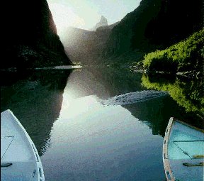
#20. THE LITTLE COLORADO ENTERS THE RIVER, mile 61.5
This is a very muddy river carrying earth and silt into the "clean" Colorado.
Although the Little Colorado River is a major tributary to the Colorado River, there are
no significant rapids here because of the size of the material being transported by the
two streams. Large boulders are transported by the main stream, but pebbles and sand are
carried by the Little Colorado River. Instead of building a pile of rocks, making rapids,
the Little Colorado has built a prominent sand bar which is easily eroded and modified by
the waters of the Colorado River. The Colorado becomes colored with the sands of the
Little Colorado.
#21. Another view of the confluence of the two rivers. These pictures of the confluence
shows very clearly how the waters of the two rivers come together.
#22. UNKAR CREEK RAPIDS, Mile 72.4 Unkar Creek Rapids
has a 25 foot drop in a distance of about three tenths of a mile. These rapids are rated a "6" on the scale. Powell's expedition did not run these rapids, but carried
their boats around the rapids. In those days the men "portaged" the rapids of
the river whenever they could as it was much safer to do so.
#23. OUR CAMP NEAR UNKAR RAPIDS Each night the rafts
pulled into an area to camp. There are no "facilities" anywhere along the River.
The rafts carried portable toilets which were placed in strategic places when we camped.
Sometimes the camps were set up on ground, and sometimes on pure granite! Not very soft!
At Unkar Creek the Indians farmed the sandy bars. They built a village on the North side
of the creek. The School of American Research, Santa Fe, New Mexico, conducted
archaeological investiga-tions in 1967-68.
#24. The Jensens The group is ready to load the raft for
a new day! The orange boxes contain food and items to outfit
the rafts for the trip.
#25. Pink Dike in the old Metamorphic Complex The
pinkish cliffs in the distance may contain different types of rock such as quartz, caused
by shifting of the earth over millions of years. Metamorphic changes in the rocks are due,
to the great pressures exerted in tilting and uplifting the earth during earthquakes.
#26. ABANDONED SMALL METAL BOAT, Mile 107.6 (Bass
Canyon) This old abandoned boat belonged to William Bass. It is located about 50 feet
above the water level on the left bank of the River. Bass was a pros-pector in the area at
the turn of the century, and was able to extract minor quantities of copper and asbestos
from this vicinity. He went broke after he transported a few loads out of the canyon.
Bass' operation is one of over 100 attempts to exploit the mineral deposits in the Grand
Canyon. The only mineral exploration which has proven to be economical to date is a
uranium mine which is now operated on the South Rim of the Powell Monument, west of the
Grand Canyon Village. Bass died in 1933. His ashes were scattered over the Holy Grail
Temple area on the North Rim, five miles to the northeast of Bass Canyon. 5. p37
#27., #28., & #29. RAFTS ON THE RIVER-Geology
Lectures
a. Geology of the Canyon was always on our minds.
b. Here we are studying the Canyon walls as we learn about time millions of years ago when
all of this area was covered with ocean. Shells and fossils have been found embedded in
deep layers of the sedimentary rock.
c. We made a rest stop here along the River.
#30. & #31. ELVES CHASM, Mile 116.5
a. Fern dotted walls surround a beautiful waterfall and swimming hole here. Perhaps elves
danced here.
b. Here is a closer view of a lovely spot.
#32. & #33. DEER CREEK FALLS, Mile 136.3
a. The waterfall here is over 100 feet high.
b. The water from the Deer Creek Falls has developed a lush growth of vegetation.
#34. HAVASU CANYON, Mile 156.9 Havasu Canyon enters the
main Grand Canyon from the south. Some rock and debris form rapids at the mouth of the
canyon.
#35. & #36. HAVASU CREEK Blue-Green Water
a. The color of the water comes from minerals in the area. The Havasupal Indian
Reservation is 12 miles up the canyon on the southeast.
b. Havasu Creek appears to be a narrow passage opening with a minor blue tributary to the
Colorado River. However, this narrow passage opens up to become a broad canyon with
spectacular waterfalls of blue green waters within the vicinity of the Havasupal
Reservation. The Havasupal Indians are the only people presently inhabiting the Canyon.
They are the only people to have lived in the Grand Canyon since the Pueblo Culture. The
name Havasupal means, "people of the blue-green waters."
#37. BIG HORN SHEEP There are three big horn sheep in
the center of this picture. We assume that they are native to the area.
#38. #39. #40. LAVA FALLS RAPIDS, Mile 179.3 a. Lava
Falls Rapids has a 37 foot drop. b. It is one of the largest rapids in the Grand Canyon.
c. It is rated from 8~ to 10 on the scale, depending on the amount of water flowing
through the rapids.
#41. JIM HALL TAKING HIS RAFT THROUGH LAVA FALLS Lava
Falls is situated in a spot where the rapids can be seen from rocks at the side of the
River. All of our rafts pulled over to the side so that we could get off and watch as the
other rafts went through the rapids. This was an exciting time!
#42. JIM HALL COMING OUT OF LAVA RAPIDS The water is
still moving rapidly, but it changes from choppy to smooth quite fast.
#43. VIEW OF MOHAWK CANYON-Through Canyon Walls This was
our last stop where we disembarked, camped, and said good bye to our great Boatmen.
#44 & #45. OUR LAST CAMPS
a. Our last camp was on the white sand beach of Mohawk} Canyon.
b. It was a luxury compared to the some of the rocky campsites we had.
#46. The Boatmen Cooking The picture shows that there is smoke from the fir' They always
cooked a big breakfast for us. In fact, the food was always excellent.
#47. & #48. THE HELICOPTER TAKING SOME OF OUR GROUP
a. This was the first time that a helicopter was used to take the class out of the Grand
Canyon. In the past the group had to hike up and out. The helicopter could only take four
or five of us out at a time with all of our duffel bags.
b. We looked down over the River and Lava Falls Rapids as we flew this short trip up to
Tuweap Airport.
#49 SINGLE WING 6 PASSENGER PLANE
This plane flew us from Tuweap Airport to Boulder City.
#50. VIEW OF HOOVER DAM FROM THE SMALL PLANE We can see
here how Hoover Dam was built at a very narrow section of the Colorado River. It completed
in 1929. We had a beautiful view from the plane of the amazing extension of Lake Mead;
waters of the Colorado River held back by Hoover Dam.
When we landed at Boulder Airport our bus was waiting to
take us back to San Bernardino Valley College, our starting point.
THE COLORADO RIVER GIVES A DAM GOOD RIDE
How does it happen that Lee's Ferry became the place in
the Colorado River to be labeled "Mile 0"? It certainly seems to be out there in
the middle of everything. Well, it is a long story, but here it is in a nutshell.
The Colorado River sources come from two major Rivers.
The Green River begins up near the Continental Divide in Wyoming, and flows 750 miles to
the Colorado River. What was once called the Grand River has its beginnings in the Never
Summer Mountains in Colorado, and flows 240 miles to the junction. At the confluence of
the two rivers, they became the Colorado River. A Colorado Congressman, Edward Taylor,
claimed that although the Green River was much longer, the Grand River had the most water,
and the whole river should be named the Colorado River. Congress agreed in, 1921, and it
was done.
The Colorado flows into two basins, the upper basin
serving Wyoming, Colorado, most of Utah, parts of Arizona, and New Mexico. The lower basin
serves California, Nevada, most of Arizona, parts of New Mexico, and Utah. The Colorado
River Compact of 1922, agrees that each of these basins, in theory, should be allotted one
half of the water. It didn't end the fight over water, but it paved the way for future
agreements.
Glen Canyon Dam was one of the agreements, and Lake Powell came into being. It was a very
controversial project because of all of the very beautiful land now covered by Lake
Powell. Lee's Ferry is the dividing point between the two basins. Mile 0, begins the lower
basin area. Sunset Magazine p 97
In the early days of the exploration of the Colorado
River the men took their boats out of the water and carried them around the falls and
rapids of the River. The River was wild, and many men lost their lives while trying to
explore the region. It was treacherous to try to go through the rapids, and much safer to "portage" the dangerous areas where possible.
Now days we look forward to the fun and the thrill of
riding out the rapids on these rubber rafts. Times have changed! Not only do we have much
different equipment to ride down the Colorado, but this great Colorado River has been "tamed" tremendously by man, and it is no longer allowed to run freely as it did
in the days of John Powell. The Glen Canyon Dam holds millions of acres of water in Lake
Powell, and, Hoover Dam, likewise, holds back even more waters in Lake Mead. Man controls
the water that flows down the Colorado River through those Dams, carefully measuring, and
"allotting" the water passing through.
Hoover Dam is a grand achievement by man. Its
architecture and engineering are magnificent, and Lake Mead is 110 miles long. The whole
area looks like a work of art from an airplane flying over.
Rafting on the Colorado River is just part of the icing
on the cake. When we look at the big picture of the Colorado River it is a picture of man
conquering a huge source of water for his use of its power in making electricity, its use
for irrigation, for industry, and supplying water for our growing cities.
The Colorado River is dammed in 10 places along its 1400
miles, and it falls 2 miles on its course from the Colorado Mountains to the Sea of
Cortez. Its tributaries are also dammed in countless places before the water reaches the
confluences. What I call the "icing on the cake," are all of the beautiful
recreation areas built up along the River. The largest of them are the first, Hoover
Dam's, Lake Mead Recreation Area, and second, Glen Canyon Dam's, Lake Powell Recreation
Area. Millions of people enjoy the privilege of use in these areas each year. These places
also provide for thousands of jobs.
- "Dam after dam backed up the Colorado's water which
was siphoned off from the river in all directions and for all needs. Today after a little
more than sixty years of dam building, the water experts tell us the Colorado River is
"over committed." There is not enough water in the river to fulfill the demands
made upon it.
John Wesley Powell was right." 10. p. 145
It is true that John Wesley Powell warned against over
use and development of the Colorado River after his 1872 exploration, and he warned
congress about how water rights should be assigned as property was sold, or made
available. In those days the thoughts were only about small farms, and individual owners.
not large land companies demanding water for irrigation. In these United States thoughts
come in much larger sizes. Perhaps we must stop and take in account how we can hold the
waters of the Colorado River at a level of use that it is capable of handling.
I prefer to believe that man has conquered the River,
and saved the water to get the best possible use of it. For example, making electricity,
providing drinking water for millions of people, for animals and for irrigation. Rafting
down the Colorado River was a real bonus, part of the "icing on the cake, "and
it has been enjoyed by thousands of people. The Colorado River is "Grand" in its
beauty, and "Grand" in all it does for man kind. However, we must be very
careful and guard against loosing it. Conservation of water is surely going to be a
"must" for all of us.
BIBLIOGRAPHY
SOURCES
1. Beal, Merril D. GRAND CANYON, The Story Behind the
Scenery, K.C. Publications, Inc., Las Vegas, NV 1983
2. Breed, Wm. J. & Evelyn Roat, eds. GEOLOGY OF THE GRAND CANYON, Museum of Northern
Arizona and Grand Canyon Natural History Assoc., Northland Press, Flagstaff, AZ 1976
3. Fradkin, Philip A RIVER NO MORE, Alfred A. Knopf, Inc., Publisher, New York, NY 1981
4. Hamblin, W. Kenneth, & J. Keith Rigby, GUIDEBOOK TO THE COLORADO RIVER PART I,
Brigham Young University, Provo, Utah, 1968
5. Hamblin, W. Kenneth, & J. Keith Rigby, GUIDEBOOK TO THE COLORADO RIVER PART II,
Brigham Young University, Provo, Utah, 1969
6. Rabbit, Mary C., Edwin D. McKee, Charles B. Hunt, Luna B. Leopold, THE COLORADO RIVER
REGION and JOHN WESLEY POWELL, Geological Survey Professional Paper 669, United States
Government Printing Office, Washington, D.C. 1969
7. Schaff, Robert ea., with the cooperation of the National Park Service, GRAND CANYON
NATIONAL PARK, David McKay Company, Inc., New York, NY 1967
8. Udall, Stewart L., and eds. of Country Beautiful Corporation, THE NATIONAL PARKS OF
AMERICA, Published by Country Beautiful Corporation, Waukesha, Wisconsin, 1976
9. Wallace, Robert, and Eds. of Time Life Books, THE GRAND CANYON, PUBLISHED BY Times
Inc., 1973
10. Watkins, T.H., & Contributors: THE GRAND COLORADO, The story of a River and Its
Canyons, American West Publishing Company, Palo Alto, CA, 1969
11. Weir, Bill, ARIZONA TRAVELER'S HANDBOOK, Moon Publications Inc., Chico, CA, June, 1992
12. Whitney, Stephen, FIELD GUIDE TO THE GRAND CANYON, William Morrow & Co., New York,
NY, 1982
OTHER PUBLICATIONS
13. SUNSET The magazine of Western Living, "Our
mighty and troubled Colorado" May 1983, Lane Publishing Co., Boulder, Colorado, 80321
14. PICTORIAL COLOR MAP OF GRAND CANYON, by Jack L. Currey, Copyright 1972, Paragon Press,
Salt Lake City, Utah 84106
|